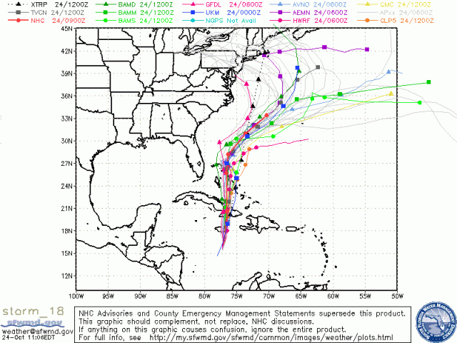
It’s been 24 hours since I first brought up the idea that now Hurricane Sandy (or what extratropical cyclone she will become) may affect the Mahoning Valley next week. Well, in those 24 hours nothing has gotten easier from a forecasting standpoint.
Both scenarios still exist. Sandy may exit quietly out into the open Atlantic and do no more harm than affecting the areas it will impact in the near future, such as Jamaica, Cuba the Bahamas, and Florida. The other one, which only one model had yesterday coming up the east coast, now has a little more weight. A few more models have come onto this solution.
This second solution would mean more “interesting” weather for New England and possibly the Mahoning Valley. We could possibly be on the backdoor side of the storm receiving wrap-around moisture (which with the cold would possibly be snow).
Regardless of what happens with Sandy, and yes we have PLENTY of time to monitor it – and a lot can (and will) change in the next week, we have a big pattern shift coming.
If you can, PLEASE take off work Thursday, it’s going to be close to a record-warm day. We will have high temperatures in the upper 70s to near 80 degrees under mostly sunny skies. That big trough that will have so much to do with Sandy will bring us a reality check for exactly what month of the calendar year we are in. By the end of this weekend, our highs will only be in the 40s and 50s.
That’s probably about the only “easy” part of the forecast for the next week, so get out and enjoy it!

